Some really great information is available if you have concerns over flooding. Thanks to the folks at Snohomish County Public Works for passing it along.
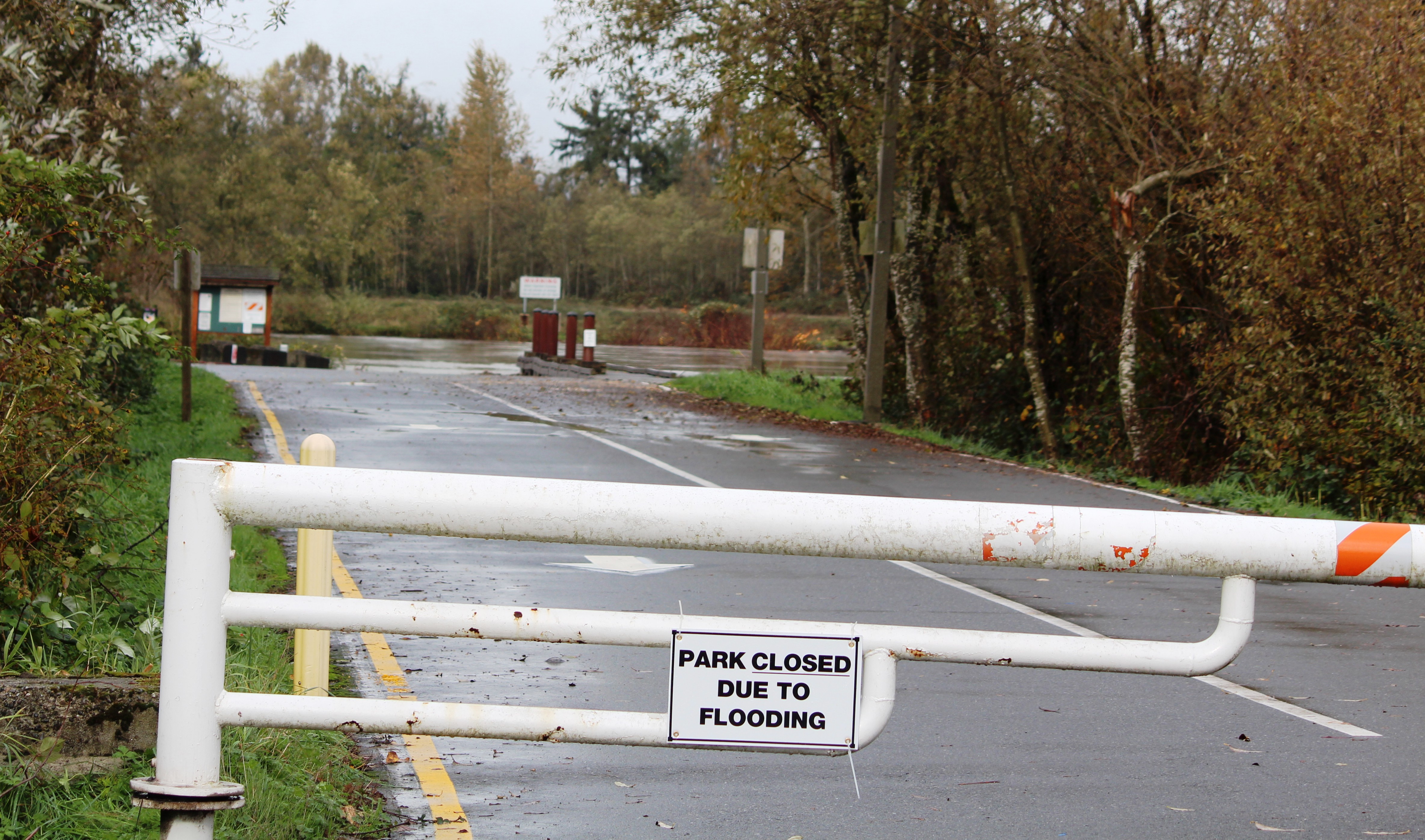
Rotary Park and Boat Launch have closed multiple times due to flooding
With the rainy season underway, the Snohomish County Public Works Department has mailed about 8,500 copies of its “Flood Safety in Snohomish County” pamphlet to residents who live in or near 100-year-floodplains.
More than 2,000 copies are in the process of being delivered to local libraries, city halls, fire departments and the county’s administrative office building in downtown Everett. The Flood Safety guide is also available online: https://snohomishcountywa.gov/DocumentCenter/View/6787.
“The impact of flooding can be serious especially in the floodplains, so we annually update our flood safety guide to keep residents informed of how they can be prepared,” said Public Works Surface Water Management Director Gregg Farris. “We recognize that Snohomish County has numerous rivers and streams close to where people live and work; this guide is an invaluable tool to being prepared.”
The 16-page pamphlet provides current resources and helpful information on avoiding, preparing for, and coping with floods. It also provides preparedness tips such as researching your property’s flood risk and protecting your home, as well as steps to recover from a flood.
Listed below are additional flood resources available from Snohomish County:
Resources Provided by Snohomish County Public Works Surface Water Management (SWM):
a. Flood Information Center Webpage – A one-stop flood information source can be found at: https://snohomishcountywa.gov/796
b. Elevations, Relocations & Buyout Technical Assistance – Owners of flood-prone homes may seek one-on-one assistance with projects that will provide cost-effective, long-term relief from repeated flood damages. Details at: https://snohomishcountywa.gov/785
c. Real-Time Flood Information System – This website enables residents to view real-time river depths and flows as well as rain gauges throughout the county. This online tool offers maps, graphs, historical data and an interactive map. Users can access online info via smartphones as well. Available at: https://snohomish.onerain.com
d. Financial Assistance – The Federal Emergency Management Agency (FEMA) funds programs under which Snohomish County can sponsor an application on a homeowner’s behalf. More information at: https://snohomishcountywa.gov/785
Resources Provided by Planning and Development Services (PDS):
a. Flood Hazard Determination Services – Residents can use this service to determine a specific property’s flood risk and regulatory base flood elevation. Contact PDS for more information: https://www.snohomishcountywa.gov/2927/Flood-Hazard
b. Flood Insurance Rate Maps (also known as FIRM maps) – The preliminary flood hazard maps are the official maps on which the Federal Emergency Management Agency (FEMA) has delineated special flood hazard areas and risk zones. They show the location of a property relative to special flood hazard areas, which is one of the factors determining flood insurance rates. For more information, see: https://snohomishcountywa.gov/893/DFIRM-Floodplain-Maps
c. Development Requirements – Staff in Planning and Development Services assist property owners with understanding how to construct or retrofit their new or existing homes to be safer from flooding. Call PDS for more information: 425-388-3311.
Resources Provided by the Department of Emergency Management (DEM):
a. GovDelivery (Public Alert) – Residents can receive information and tips on disaster preparedness. Register at: https://snohomishcountywa.gov/3862
b. Essentials of Flood Preparedness List – This resource will help you assemble an emergency supplies kit, prepare an emergency plan, and stay informed. Details at: https://snohomishcountywa.gov/DocumentCenter/View/6783
-
- Snohomish County Hazard Viewer – Explore interactive maps showing known natural hazards, including flood zones, earthquake faults, landslide history and the potential for wildfire. Details at: https://bit.ly/2AKEbhH
d. SnoCoAlerts – Residents can register and receive emergency alerts, such as those related to evacuations, imminent danger and local area emergencies. Register at: https://snohomishcountywa.gov/620/Public-Alert-Resources


October 24, 2019
Everett